Olympic National Park is one of the country’s largest and most diverse parks. The park is so large that driving between areas can take hours. It is also such a diverse ecosystem that you can be on the beach, then a rainforest, glaciated mountains, and wild rivers. It’s quite something to explore.
The park offers some incredible hikes, and if your time is limited, it’s worth exploring its diverse areas. We help you plan your time with some of our favorite hikes in the park. They range from easy to strenuous and are perfect for all skill levels.

Mount Storm King
Trailhead | Length: 4.1 miles | Type: Out & Back | Difficulty: Strenuous
One of the hardest and best hikes in the park. Mount Storm King is known for steep inclines, nerve-wracking ascents, and stunning views. The payoff of this hike is one of the best in the region, but the hike itself is not for the faint of heart. You should only attempt the hike in good weather.
The hike is strenuous, seeing about 2,100 feet of elevation gain over about a 2-mile ascent. About 1.8 miles into the hike, you reach the “end of maintained trail,” and from here, the trail gets a bit hairy. You’ll traverse a ridge and arrive at the “rope section.” It’s a steep ascent with some ropes that other hikers have installed to help with the climb.
Trust the ropes as much as you feel comfortable. One of the things I recommend is either to bring your own gloves or borrow one left by other hikers. It’s not as necessary on the way up, but I found it very useful on the descent.
The last section is a rocky section that was the most nerve-wracking to me. Once you get past this part, however, the views are phenomenal.
For more information, check out our Guide on Mount Storm King Hike.
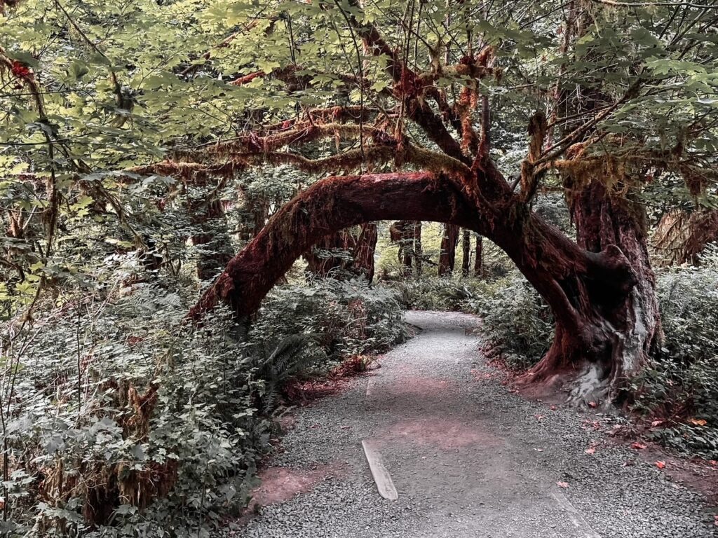
Hall of Mosses
Trailhead | Length: 1.1 miles | Type: Loop | Difficulty: Easy
This 1-mile hike is the one anticipated hike in Olympic National Park. And it makes sense. It truly highlights the magic of the temperate rainforests of the Olympic Peninsula. The mosses are the highlight, covering nearly every surface along this hike.
It’s something that photos don’t do justice for. The hike ascends to a loop that takes you through this section of the forest.
The Hall of Mosses hike is incredibly popular, and during high season, parking can be a headache. I recommend exploring this area either early or late in the day. I love both times of day. I’ve visited late in the day and even had the hike to myself! Early in the day makes it easy to add in the other hikes in the area too.

Spruce Nature Trail
Trailhead | Length: 1.4 miles | Type: Out & Back | Difficulty: Easy
A great complement to the Hall of Mosses, Spruce Nature Trail takes you through a beautiful portion of the old rainforest. It doesn’t have the reputation of Hall of Mosses and maybe that trail is more beautiful. But that seems to reduce the crowds here, which is a bonus. Also, you get views of the river from this trail.
This is a perfect trail with the Hall of Mosses, and it’s good to try to gauge crowds to determine which order to hike them in. This trail is also incredibly flat, so it’s perfect for all visitors.

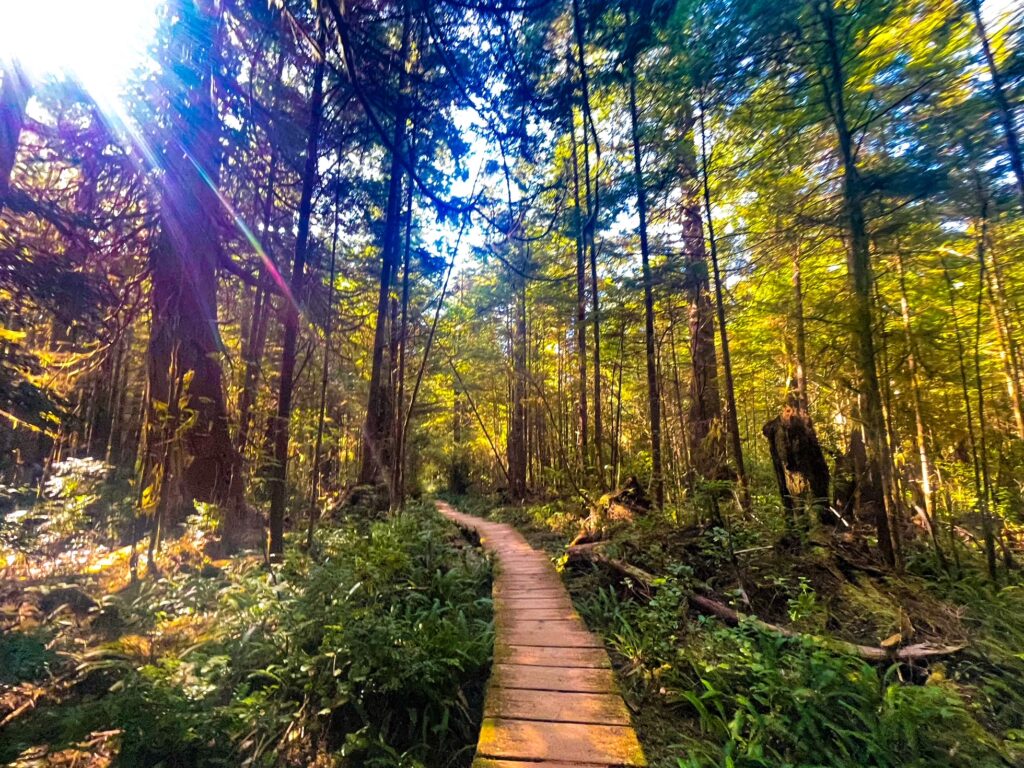
Hoh River Trail (to Mineral Creek Falls)
Trailhead | Length: 5.5 miles | Type: Out & Back | Difficulty: Easy-Moderate
Finding a good turnaround along the Hoh River Trail is tough. The trail itself goes for miles, and you can hike 17ish miles out to Glacier Meadows, and many do this as an overnight.
However, there are a lot of places to turn around. For most, we believe that Mineral Creek Falls gives you enough of the hike and a nice pay-off point. Mineral Falls are about 2.7 miles down this river following trail. You’ll pass over several bridges along your hike as well.
The waterfall is on the left as you hike out. Some folks miss it, so if you see the turnoff for Tom’s Creek, you’ve gone too far. The hike is an out-and-back, so you can also turn around anywhere before or after the falls. 5-mile island is another popular turn-around about 2.3 miles beyond the falls.

Sol Duc Falls Trail
Trailhead | Length: 1.8 miles | Type: Out & Back | Difficulty: Easy
This is the most impressive of the falls in this guide. Sol Duc Falls is only 50 feet in height, but the drop into the slot canyon is just stunning to see.
The hike is beautiful, too, through the forest across the trail and bridges. It’s a pretty easy hike for most folks, with the trail being mostly flat along the entire length. The highlight is reaching the viewing area of the falls along the bridge over the slot canyon.
Be careful around the falls. There are lots of folks who climb down onto the rocks and some who take risks that seem unnecessary. I don’t recommend this, as the rocks in that area are wet and slippery.

Marymere Falls
Trailhead | Length: 1.7 miles | Type: Out & Back | Difficulty: Easy
Marymere Falls is a beautiful 90-ft falls located close to Lake Crescent. The hike is a very straightforward and short hike out to the falls. As you approach there are a series of bridges and boardwalks.
The boardwalks take you in a loop around the falls. The loop is unnecessary, and just going out and back to the falls is faster if the crowds are low. I think the boardwalk is there for crowd control more than scenery.
If you are planning on attempting Mount Storm King, I recommend planning to do both of these trails together as they share the same start of the trail. Parking is also tricky, so arrive early in the day if possible.

Madison Falls
Trailhead | Length: 0.2 miles | Type: Out & Back | Difficulty: Easy
Barely a hike, but worth a stop to visit a beautiful waterfall. Madison Falls, located along Olympic Hot Spring Road, is a nice quick stop between Port Angeles and Lake Crescent.
The 60-foot waterfall is beautiful, and it’s one of the easiest and most accessible in the park. The trail is mostly flat, with a gentle slope down to the viewing area of the waterfall.
Parking turns over regularly, so don’t worry if you arrive and there’s no parking. You’ll probably find a spot shortly.
Cape Alava
Trailhead | Length: 7 miles | Type: Out & Back | Difficulty: Moderate
One of my favorite trails in the park. Cape Alava takes you to the Westernmost Point in the continental US and some of the best wild beaches in Washington.
The trail winds through the rainforest along trails and boardwalks, and even this part of the hike is simply beautiful. But the payoff is when you reach the beach and can wander along what is often minimally visited.
The hike can be done as either an out-and-back or a loop. The loop heads sound to Sand Beach and then along another trail back towards Ozette Ranger Station. You can also hike north along the beach, but check any restrictions for the Makah Reservation first.
Camping is also possible on the beach and requires prior registration. For more information on the hike and camping, check our Guide to Cape Alava.

Rialto Hole in the Wall
Trailhead | Length: 3.3 miles | Type: Out & Back | Difficulty: Moderate
This hike is one of the most popular of the wild beach hikes in Olympic NP. The hike takes you along a log-strewn beach abutting old-growth rainforest. The beach trail is a beautiful hike that culminates at the “hole in the wall,” which is an outcropping with a hole through it.
During low tide, it is possible to hike through the hole. Outside of that time, it’s not recommended, as the rocks are jagged, and the waves can hit you while you traverse it. The hole can be done as a loop as there’s a way up and down the ridge you see along the beach.
I found it possible to do the entire hike except for the hole without getting wet. It requires a bit of creative climbing over debris, but something to note if you want to see it without getting soaked.

Hurricane Hill
Trailhead | Length: 3.4 miles | Type: Out & Back | Difficulty: Easy-Moderate
Hurricane Hill is a moderate hiking trail in the Hurricane Ridge region of the Olympic National Park. The hike is an out-and-back hike with about 820 feet of elevation gain.
It’s a popular hike and one with some of the best views over the alpine region of Olympic NP. The summit of the hike actually has a few different viewpoints you can explore for different views over the area.
It’s worth checking out the various views when you reach the summit. On a clear day, you can see quite far, including the highest peaks in the region and the nearby water inlets.

Devil’s Punchbowl
Trailhead | Length: 2.4 miles | Type: Out & Back | Difficulty: Easy
I don’t know if this is more popular for biking or hiking, but it’s a great trail to explore either way. The trail takes you along the much longer Spruce Railroad trail. The trail follows an old rail line used for logging in the Pacific Northwest.
The trail is much longer if you want to do the entire thing. But the highlight here is the Devil’s Punchbowl. This beautiful swimming hole is a popular destination for folks in Olympic and it’s easy to see why.
The hole is small and can be very crowded in the summer. If you go, I recommend doing the punchbowl area as a loop. You’ll get the chance to go through the train tunnel this way.

Sunrise View Point
Trailhead | Length: 0.9 miles | Type: Loop | Difficulty: Easy
This trail is one of the most popular easy trails in the Hurricane Ridge Region of Olympic National Park. This 0.9-mile hike takes you to Sunrise Point, with incredible views of the area and onto British Columbia.
The hike is popular, especially during Sunrise and Sunset. In particular, Sunrise, as the name suggests, has lovely views if you can get here early.
The hike is popular, short, and has limited coverage. It’s recommended to hike early or late in the day when the sun isn’t so intense.
Where to Stay in Olympic National Park
Having a convenient home base for everything in Olympic NP is impossible. The park is large and requires you to drive around the outside of the park to visit most of the sites. It takes hours to drive between different regions of the park. Therefore we will give you some options on where to stay. If you pick a single location, we recommend grouping your activities for the day in each region.
- PORT ANGELES: Red Lion: One of my favorite hotels in the region. Also an excellent location for those taking the ferry to/from Vancouver Island. Good service and close to restaurants in town.
- PORT ANGELES: Port Angeles Inn: Another favorite of mine. Located on the edge of the “downtown.” It’s close to restaurants, clean, with good service.
- FORK: Pacific Inn Motel: I think the best in town. Great rooms, some with kitchens. Clean, generally affordable, and friendly service.
- FORK: Dew Drop Inn: Another good option in Fork. Clean, with nice rooms, and friendly staff.
Camping
- Fairholme Campground: 88 Sites. Reservations Recommended. West side of Lake Crescent
- Graves Creek Campground: 30 sites: First Come, First Served: Quinault Rain Forest
- Hoh Rain Forest Campground: 78 sites; Reservations Required during high season: Hoh Rain Forest
Other Posts You May Like
- WASHINGTON: NPS: San Juan Islands NHP: The War of the Pig
- WASHINGTON: Exploring Ebey’s Landing National Historic Reserve
- WASHINGTON: Best National Parks in Washington State
- MONTANA: Guide to Grant-Kohrs Ranch National Historic Site – Montana
- MONTANA: Best Day Hikes in Glacier National Park
Leave a Reply