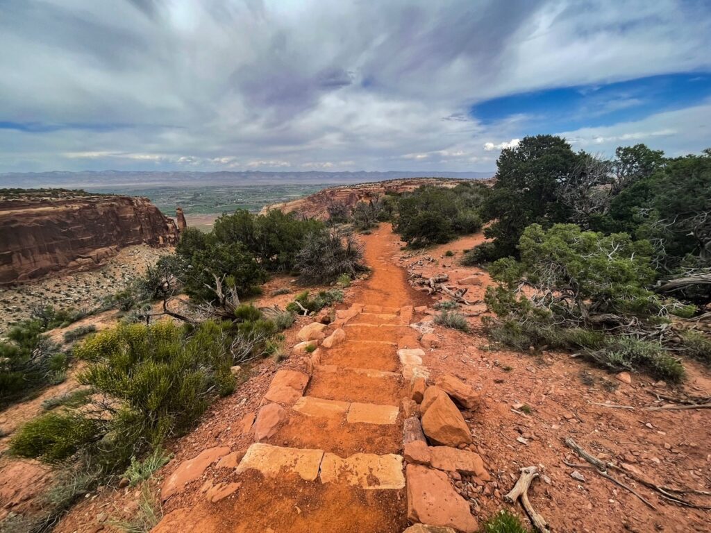
Colorado National Monument really was a surprise for me. I thought it was going to be a small place, however it is one of the larger monuments you can drive through and brings you along the beautiful ridge of the canyon with incredible views of rock outcroppings.
Otto’s Trail has some of the best views of the park with views of some of the famous outcroppings of the area. It’s also one of the more popular short hikes of the park.

About Otto’s Trail
Distance: .5 miles | Type: Out & Back | Difficulty: Easy | Avg. Time: 20 mins.
Otto’s Trail is one of the easier and shorter trails of Colorado National Monument. It starts south of the visitor center and gives hikers views of some of the most impressive rock outcroppings within the canyon. Actually if you want to see some of the most popular rock outcroppings such as Independence Monument, this is one of the best ways to do it. It’s also a good companion for the canyon rim trail that starts near the visitor center, giving visitors views of that side of the canyon.
Otto’s Trail was named for John Otto who lived and loved the canyon for many years. He was instrumental in protection of the canyon and would write regularly for its protection. Places such as Independence Monument and Liberty Cap were named by him. On the Trail you can walk a bit in his footsteps.
Independence Monument is the most famous of the rocks you can see from the trail. Named so for its use during Independence Day Celebrations. Tradition has it that climbers scale the monument and place a US flag at the top in memorial of Independence Day. The tradition started with John Otto in 1911 and continue to this day with members of the Mesa County Search and Rescue scaling it annually.

Getting There
Address: Otto’s Trail, Grand Junction, CO 81507
Otto’s Trail is located just south of the Visitor’s Center along Rimrock Drive. There’s a small parking area by the trailhead that can fill up if there’s more than a few cars. However, we didn’t really have much of an issue parking and the short length of the trail means turn-over can be pretty fast.

Hiking the Trail
The trail starts from the road along Rim Rock Road along the main area of Colorado National Monument. the trail is very well marked and honestly it’s pretty difficult to get lost as the area is overall pretty small.

From here you continue along the trail which takes you along this rock outcropping. Be sure to go all the way to the end of the trail as well as check out both sides of the view from the cliff.

Just be careful, don’t get too close to the edge. The rocks can be loose and there is certainly risk that areas may collapse. I would recommend viewing both the side facing the visitor center and the cliffs there as well as the other end to view the other rock outcroppings, in particular the close views of Independence Monument.

Tips & FAQs
- The trail is one of the best and easiest ways to see some of the rock structures. Worth the quick visit.
- Definitely better for seeing the “independence monument”.
- You can actually get some better views than the trail by the visitor center. Otto’s trail is better if you have limited time.
- The trail is pretty smooth. You don’t really need boots, etc. for the trail if you choose not.
- Be careful and avoid getting too close to any of the edges of the cliffs.
- The trail is particularly popular on July 4th with hikers watching climbers scale the monument. Climbers usually finish the ascent between 11:30am and 12:30pm.
Other Posts you May Like
- FLORISSANT: Visit Florissant Fossil Bed’s National Monument
- DINOSAUR: Visitor’s Guide to Dinosaur National Monument
- MESA VERDE: Cliff Dwellings Tours Guide
- ARCHES: Best Hikes of Arches National Park
Leave a Reply