One of the most interesting hikes in the park, the Grand Wash Trail Hike takes you along a “wash” which is a temporary riverbed area. The hike takes you through the wash, along canyon walls, and into a slot canyon called “the narrows”, with its high imposing walls and narrow walk way. Read along for how to do the hike, when to go, and how to maximize the fun.
Table of Contents

About the Grand Wash Hike
Distance: 4.8 Miles | Type: Out & Back | Elev. Gain: 341 Feet | Difficulty: Moderately-Easy
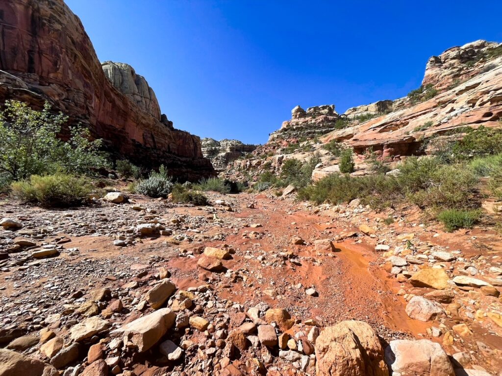
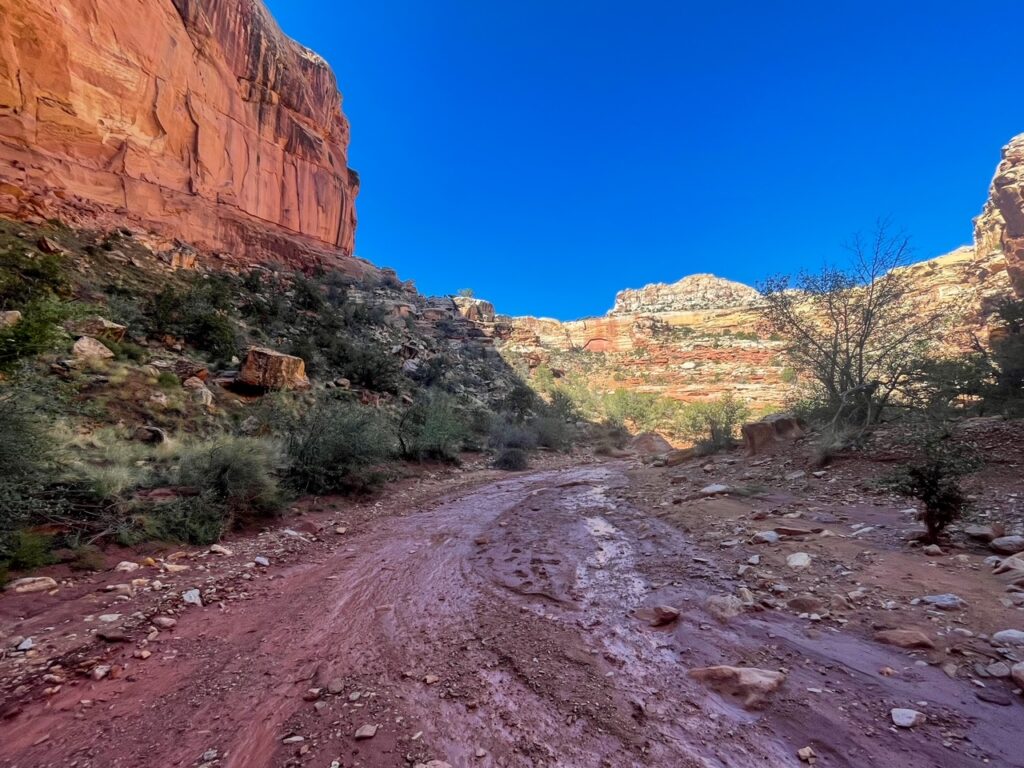
The Grand Wash Trail takes hikers through a beautiful canyon area along a wash. Wash are seasonal river beds in the desert and they are often dry during much the year. However, like in my instance, they can be very muddy after a rainstorm. The hike takes folks through the canyon and through the narrows, a gorgeous slot canyon, before continuing to the other end of the wash.
You can hike this trail as either one way or out & back. If you do one way you’ll need a car at the other end. You can even extend the trail with connections to visit Cassidy Arch or to Frying Pan Trail and Cohab Canyon. If you have a second car I would recommend doing it as one way if possible.
Warning: Slot Canyons are very dangerous during thunderstorms. If rain is in the forecast, avoid hiking the narrows at that time.
When to Do the Hike
The Grand Wash Trail is open year round and can be hiked year round. Winters an be very cold and summers very hot.
Spring and Late Fall tend to be the best times to hike the Grand Wash Trail. The weather is good and its not too hot or too cold.
Summers can be good but caution is necessary. The weather can be extremely hot during the summer. Additional summer rains can be deadly in the slot canyon area of the park. In particular there is often rains due to monsoons in the late summer.
Do Not Hike if there is rain upcoming in the forecast. In particular avoid being in the narrows during any sort of rain. Check forecasts, watch the skies, talk to the rangers, etc.

How to Get there
You can start and part on either end of the Wash. When I was there recently the end near Cassidy Arch required hiking in as the road was closed from flood damage.
For the first end that is closer to the narrows. You can drive down Route, 24, south away from the visitor center. You’ll pass by the petroglyphs and the parking for Hickman’s arch as well. About a mile more you’ll see a parking lot on the right and a sign for grand wash. The lot is not big though, and can fill up. However, there were few cars there even later in the day.
The other end of the trail is near the Cassidy arch trailhead. Normally this is reached by driving down the scenic Drive, which is accessed from the road near the Gilford homestead (be sure to stop for pie!). After about 2.3 miles you’ll see a dirt road to the left. Turn onto Grand Wash Road and continue until the parking area and trailhead.
Hiking the Grand Wash Trail
For this hike, I’m going to start from the Route 24 trailhead for the Grand Wash Hike. You could do it from either end. I did it as a one way hike, as thankfully someone who I met on the other end gave me a lift back to my car.

In the beginning of the hike, you’ll see the wash on one end of the parking area. There’s a small hill that you’ll need to go down to get into the hike. It’s a bit confusing as there’s metal mesh everywhere, but that is to keep the rocks from falling. You can walk on it to get you into the wash. Just don’t slip on the slick metal.


You’ll see a red-sand-ish river bed area that is the wash. You’ll be following this for the entire hike. If you are there after rain, the middle of the trail will be incredibly muddy. I would try to avoid as much as you can, but know, that you wont come out clean. It’s just that the center is incredibly muddy.
The hike at this point will be still through the canyon area. Although the cliff walls are not as straight up and down as slot canyons. But you’ll easily be able to figure out where the hike goes. Just follow the river bed. Also of note, there were very few people hiking at the same time as me. I saw one family leaving as I was entering and another man close to the narrows. But otherwise I didn’t see another person until I got close to Cassidy Arch Trailhead.
From here just keep continuing on through the hike. You’ll be going this way for about a mile. The trail will go back and forth a bit as the canyon moves as well.


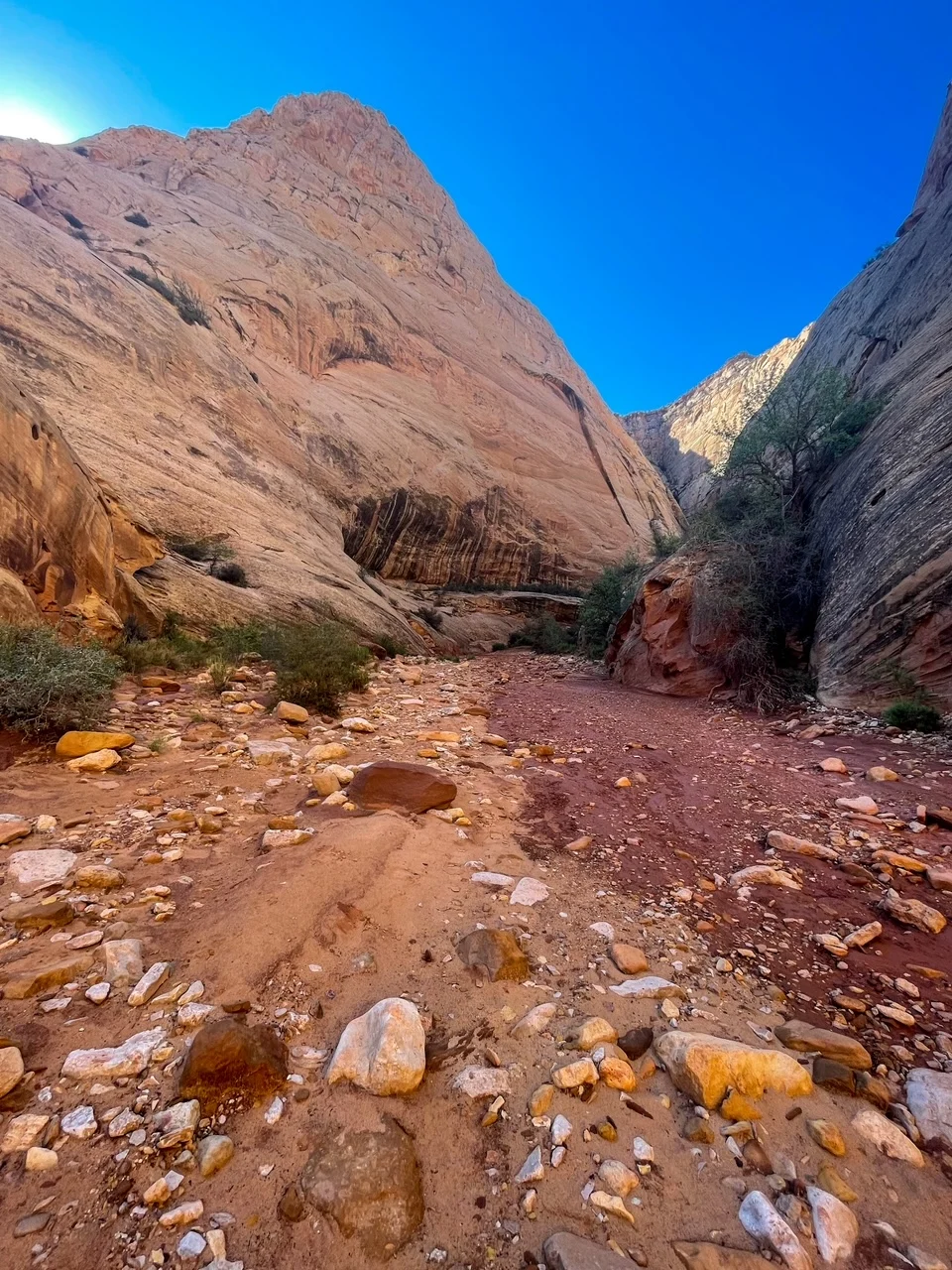
Eventually you’ll get to a spot where the canyon walls get much higher and it feels more narrow. This is the narrows, or the slot canyon that is the highlight of the hike. It’s definitely worth exploring a bit of it. It’s not that long though.


If you want this is the point where you can turn around. I would say after a bit a hike into the narrows thing start to get very same-sy and after the slot canyon things open up again as you continue through the rest of the wash. If you want, turn around, if not you can follow along some more.

From here, the narrows opens up. You’ll see that you are still in the general canyon area but you are no longer in the thin slot canyon. The trail does continue this way for awhile with the trail going back and forth a bit. You can cross over the gravely areas if you want (and if you want to save your shoes some).

At this point the trail zig zags a bit then goes up hill some. At this point you’ll see the trail will split and to your right you’ll see the trailhead for Cassidy Arch. That’s another 3 miles (out and back) of a trail if you choose to go that way.

You can continue on if you want. If you don’t want to do Cassidy Arch you can catch a glimpse of it from the trail. Although its still very far away and not a great view of the arch. But you’ll still get to see it. From here you are at the end of the Grand Wash Trail. You can either turn around, continue on the another trail, or if you parked another car here, take your car back to the other trailhead.
Tips & FAQs
- Do Not Hike If Rain is Forecast. I cannot stress this enough. People die in these slot canyons during storms. If you are unsure, talk to a ranger about the forecast and advice.
- Bring Water. It is a long and tiring hike. There is also little shade along the hike, You’ll want water especially if you are going out and back. There’s no water available on the hike.
- Pack good shoes, sunblock. I would avoid sandals or flipflops.
- The area can be muddy. Just be prepared for all the thick mud that will undoubtedly accumulate on your shoes and clothing.
- You don’t have to do the whole hike. Honestly after a bit into the narrows it doesn’t change much scenery wise. You can turn around then unless you are really after mileage or another hike.
- If you have two cars. Consider parking one at each end. It’s not worth doing as an out and back if you can avoid it.
Other Posts you May Like
- ARCHES: Best Hikes in Arches National Park
- CANYONLANDS: Completing the Upheaval Dome Trail
- CAPITOL REEF: Guide to Hickman Bridge Hike
- MESA VERDE: Advice on Cliff Dwelling Ranger Tours
- UTAH: Visiting the Bonneville Salt Flats
- UTAH: What to do in Salt Lake City
Leave a Reply