Natural Bridges are very common in Utah, and Natural Bridges National Monument contains several beautiful examples. These bridges (not to be confused with Arches) are the main draw in this somewhat remote National Monument.
If you are deciding to visit or pass through the area, this brief guide will hopefully help you plan your visit.
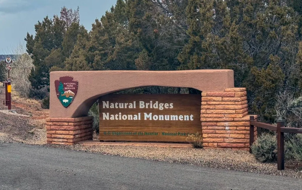
About Natural Bridges National Monument
Located in Southern Utah, Natural Bridges contains three prominent natural bridges and a Puebloan cliff dwelling within the national monument area.
Established in 1908, the park is Utah’s first national monument. It covers over 7,600 acres, and the park’s creeks, bridges, and sites offer many adventures.
The three bridges are named “Kachina,” “Owachomo,” and “Sipapu” to honor the Anasazi Puebloan people, the land’s historical inhabitants. Each bridge is unique and different.
The park is pretty remote, and there’s no cell service. The visitor center and other buildings are powered via a solar field near the park entrance.
Best Time to Visit Natural Bridges
The park is open year-round, 24 hours a day, 7 days a week. However, the road into the park may be treacherous during winter conditions, and the visitor center is closed half the week.
The best times to visit the park are from late March to October, and this is also when the weather is best. Most visitors spend about 2-3 hours at the park, enough to visit all the overlooks and maybe take a quick hike or two.
Summers are hot and can make hikes more difficult due to weather and heat. Also, check the weather if you are here between August and September during the monsoon season. You want to avoid certain hikes if there is a risk of flash floods.
Fall is gorgeous in the park. This is my favorite time of year to visit, with changing tree colors and cooler weather.
Things To Do at Natural Bridges National Monument
Three Natural Bridges and 1 Cliff dwelling are the main attractions in the park. There are also hiking options within the park that we’ll cover.
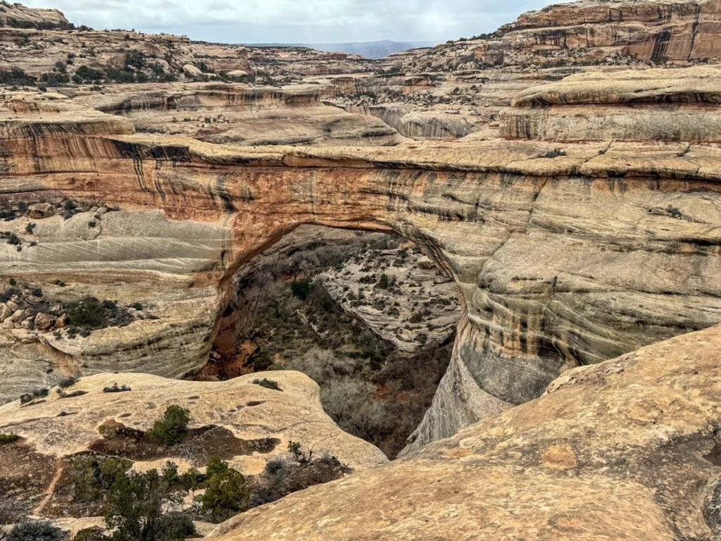
Sipapu Bridge
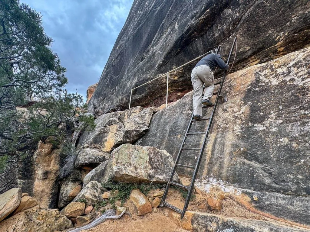
It is the largest and most visited of the three bridges (and the first you’ll encounter on the loop road). The bridge is impressive, and it’s beautiful to view it from the overlook or even the hiking trail. You’ll need to hike down the trail to get a proper view through the bridge, but the hike is worth it if you have the time and ability.
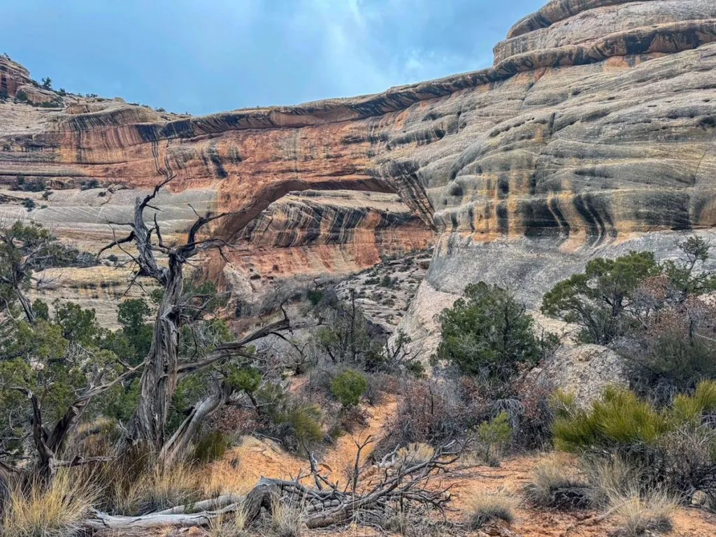
Kachina Bridge
The middle of the two bridges both in terms of when you’ll pass it on the loop road and in size. It’s the second largest bridge, and this one was one of the hardest for me to notice from the viewpoint. But it’s a beautiful bridge. It’s also the most difficult of the three bridges to hike down to get under. This makes it the least visited bridge for visitors to hike to.
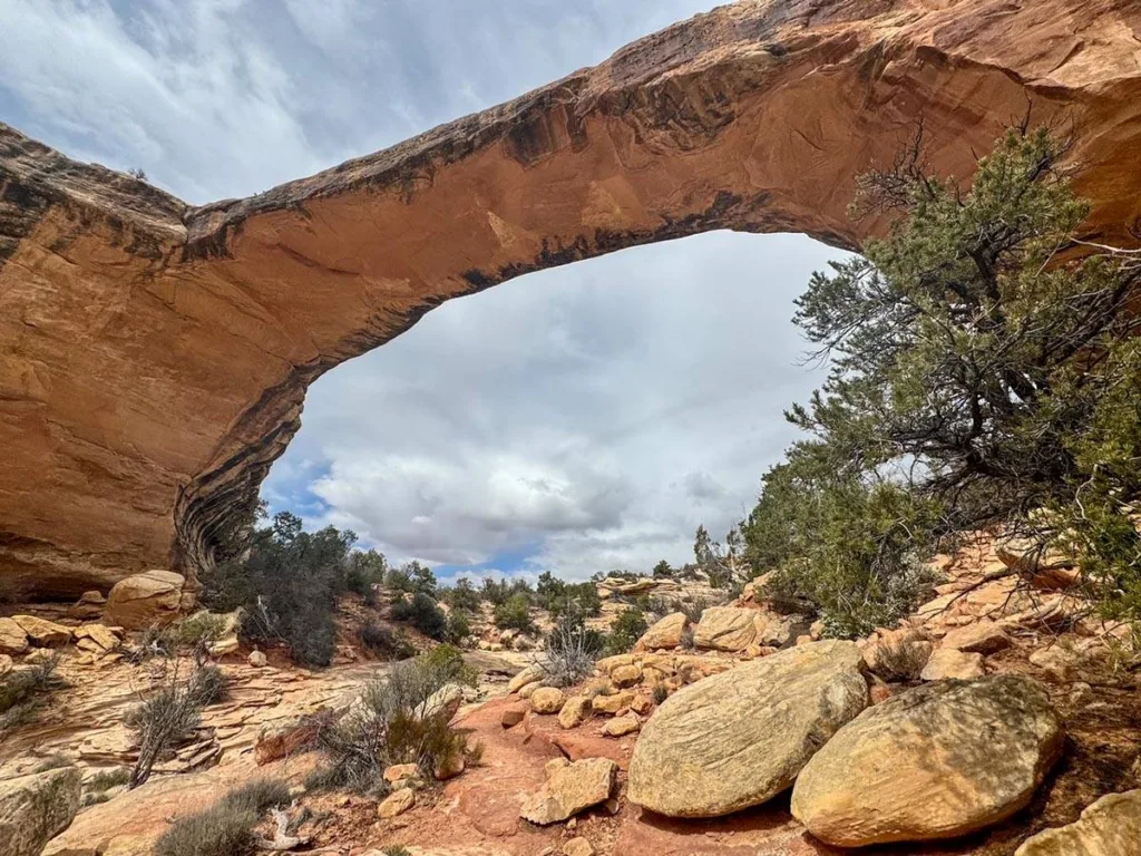
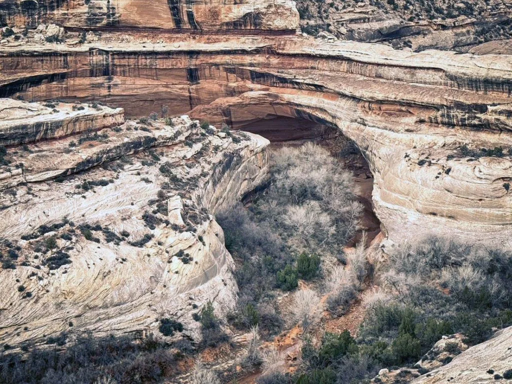
Owachomo Bridge
Owachomo is the smallest and thinnest of the three bridges. The thinner span makes it feel bigger, given how it looks. This bridge is also commonly believed to be the oldest of the three bridges in the park. It’s also the easiest of the bridges to hike down to.
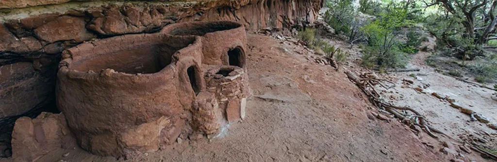
Horse Collar Ruins
Horse collar is one of the preserved historical Puebloan sites in the region. The ruins are believed to be about 700 years old, and little is known about their origins. And the only one you can see in Natural Bridges National Monument.
The ruins can be seen either from the loop trail or the overlook. The ruins are located between Sipapu and Kachina Bridge, so you’ll need to drive the loop again if you miss it. Unfortunately, we had to turn around due to a thunderstorm and didn’t make it to the ruins.
Hiking
- Horse Collar Overlook: 0.6 miles. Easy. Out & back to an overlook for the Horse Collar Ruins
- Sipapu Bridge Hike: 1.5 miles. Moderate. Out & back that descends into the valley. There’s an overlook and a path down to get under the bridge.
- Kachina Bridge Hike: 1.4 miles. Moderate. An out-and-back hike to get to the base of Kachina Bridge. Moderate but more challenging than the other bridge hikes.
- Owachomo Bridge Hike: 1 mile. Easy/Moderate. Out-and-back hike to the base of Owachomo. It’s the easiest of the 3 bridge hikes.
- Full Loop: 12 miles. Strenuous. This is the hike that visits all the bridges and the ruins. It’s primitive and not always clear how to follow. Check conditions with the visitor center before attempting.
Stargazing
The remoteness of Natural Bridges makes it an amazing night-sky location. Natural Bridges became an international dark-sky park in 2007, and protecting the dark sky here continues to be a high priority.
Where to Stay
Natural Bridges National Monument is not close to many towns in this part of Utah. Therefore, there are few places to stay. But we help you with planning if you want to stay overnight nearby. The closest town for RV sites and hotels is in Blanding, Utah.
Camping
- Natural Bridges Campground: 13 sites. All sites are first-come, first serve.
- Sunset Campground: Blanding: Located in nearby Blanding. Has tent and RV-sized sites.
Hotels
- Bears Ears Inn: Clean, nice option in Blanding. Complimentary breakfast is included too.
- Blue Sage Inn: Another good option in Blanding. Clean, comfy rooms. Free Breakfast too!
RV Parks
- Sunset Campground: Blanding: Located in nearby Blanding. Has tent and RV-sized sites.
- Blue Mountain RV Park: Blanding. Nice RV park with RV sites, tent sites, and a few cabins. Located in the town of Blanding.

Basic Information
Below is some basic information about Natural Bridges National Monument. Hopefully, this will help with your trip planning.
Visitor Center
Address: End of UT 275, Lake Powell UT
- The visitor center is typically open 9-5 days (Summer) and Thurs – Sunday (Winter)
- The center contains exhibits, bathrooms, water, a small shop, passport stamp, and of course, information about the park.
Fees
- Private Vehicle: $20
- Motorcycle: $15
- On-Foot/Bike: $10
- Natural Bridges Annual Pass: $55
It’s also included on the America the Beautiful Annual Pass ($80)
Address
Hours
- The park is open 24 hours a day. Overnight camping is only allowed in the park’s singular campground.
Passport Stamp
Website: Official NPS Website
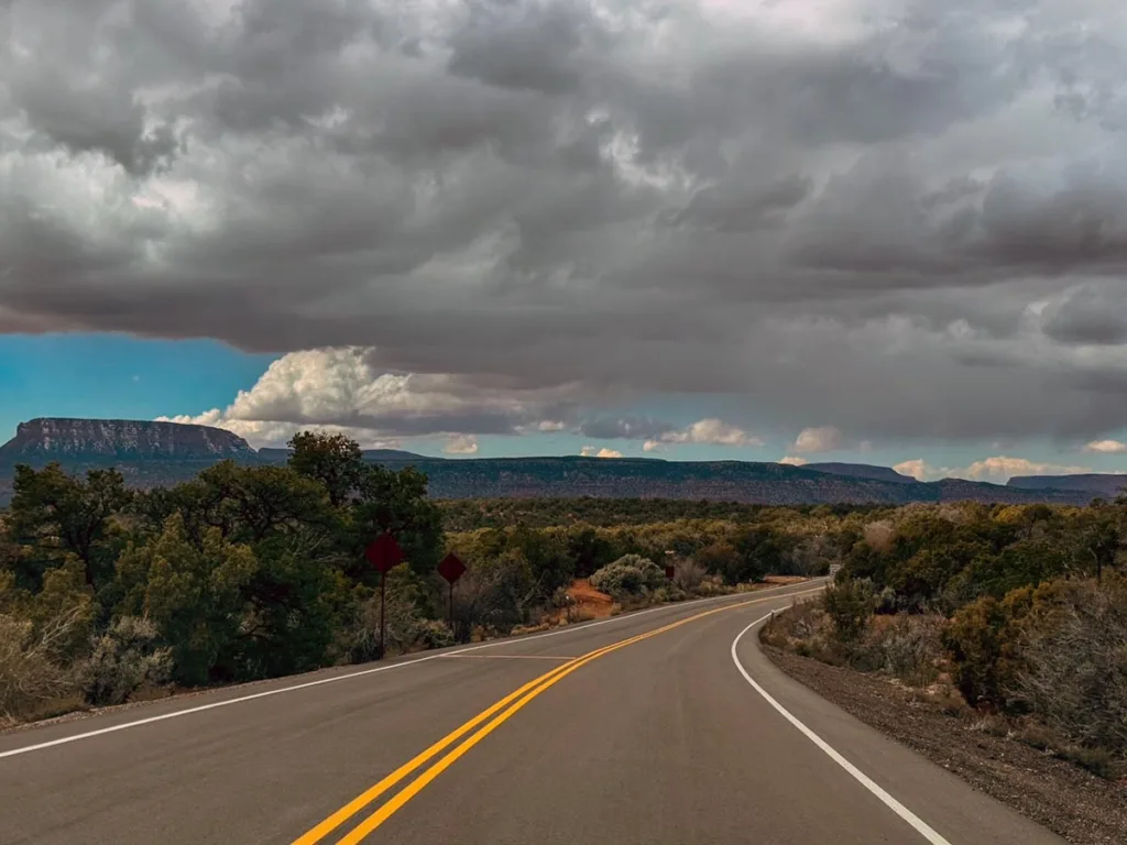
Getting To Natural Bridges NM
The closest town to Natural Bridges is Blanding Utah. This is your best option for hotel lodging and foodstuff for your visit here.
The park is located about 45 minutes from Blanding along UT-95N. Head on UT-95 until you for about 30 miles and turn right on UT-275N. Continue until you enter the park.
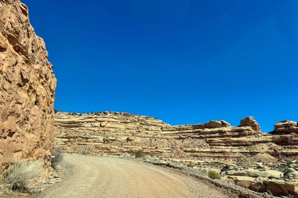
The park is also 65 miles from Monument Valley if you are coming from the south. Note. The fastest directions will take you along UT-261N. Part of that trip is unpaved on a road climbing up to a mesa top. It felt a bit scary at times.
By Air
The closest airports are Cortez Municipal Airport (CEZ) and Moab Canyonlands Airport (CNY), about two hours from Natural Bridges. Moab is the better option with United and Delta Flights. Cortez only has connections via Denver Air Connection.
Other airport options include:
- Durango (DRO): 176 miles (3 hours)
- Grand Junction (GJT): 226 miles (4 hours)
- Salt Lake City (SLC): 330 miles (5.5 hours)
Tips & FAQs
- Download any Navigation or Trail Maps before visiting Natural Bridges. Cell phone service is non-existent.
- Check the Weather for the Park. We were surprised by a sudden thunderstorm and there are some highly exposed areas in the park.
- Check the Dates and Times of the Visitor Center. In winter, it closes for part of the week.
Leave a Reply