If I had to pick my favorite trail in Big Bend National park it would be the Lost Mine Trail Hike. And I’m not alone, it is consistently ranked as one of (if not THE) top hike in the park. I was really skeptical, could it really deserve all those high scores?
Well, let’s see if you agree. And here we are to help you plan your trip to Big Bend NP and the Lost Mine Trail hike.
About the Lost Mine Trail Hike
Distance: 4.8 miles | Type: Out & Back| Avg. Time: 2.5 hours | Difficulty: Moderate | Dog Friendly: No
The trail is about 4.8 miles round trip from the trailhead at the parking lot to the summit of the lost mine trail. The trail is a perfect mix of difficulty and payoff. You’ll experience a little over 1,000 feet of elevation gain over the 2.4 miles, however it’s not all at once thankfully with some areas of gradual incline and others steeper.
There is a section of switchbacks you’ll hit about halfway over the trail. From here you’ll continue another mile until you hit what seems to be the peak. However, there’s another actual peak if you continue further along the rocky path. You’ll descend slightly before ascending once again.
The peak is a nice area with rocks and a great view over the landscape in most directions. There are a few spots you can sit to block out the wind if necessary. It’s also a perfect spot for relaxing, snacking, before heading back to the trailhead along the same trail.
Keep an eye out for wildlife. My friends said they saw a bear in the woods near the trail. Dawn and dusk tend to be the best times to see wildlife.

Lost Mine Trail Trailhead & Parking
The Lost Mine Trailhead is about 1.3 miles down Basin Junction from the Chisos Basin Visitor Center. The trailhead consists of a small parking lot that is too small for the number of hikers this trail attracts.
The trailhead sign is located on the corner of the parking lot on the side further away from the Visitor center direction. You’ll see a sign for the Lost Mine Trail with information about the hike.
From the map above you can see the visitor center highlighted with a purple semi-translucent box and the A being the location of the trailhead.
Best Time to Do the Lost Mine Trail
The best time to do the Lost Mine Trail hike tends to be from October to May when the temperatures and weather are at their best in Big Bend National Park. The trail is also the most crowded here. Temperatures in the mornings and evenings can be very cold however, so do dress appropriately. The area can also get high winds near the summit.
Summers not surprisingly are very hot, and also tend to be the low season for the park. Actually many things close down in the area during this time especially. If you do plan to visit the hike during the summer, we recommend going early in the morning to avoid the hottest part of the day.
The Lost Mine Trail Hike


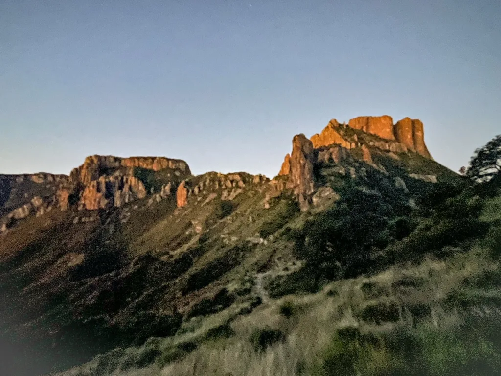
The lost mine trail starts flat from the parking lot of the trailhead. There are not many spots available so go early if you can. We tried to arrive to view the sunrise on the peak, so when we arrived we were the only folks who were at the trailhead when we departed. Bring headlamps, only 2 of the 3 of us had headlamps which worked out fine. But the area is really dark in the evenings so you’ll want a light.
The trail starts out rather mildly. The trail is not flat as it’s nearly always ascending on your way up. Note, the photos were not all taken at one time due to lighting on early morning hikes.

The trail begins in some wooded areas with some brush and then quickly as it ascends you’ll see more wide open areas. What I love about this trail is that it affords a lot of views of the area as you ascend. You are at least not fully encased in trees until you reach the summit.
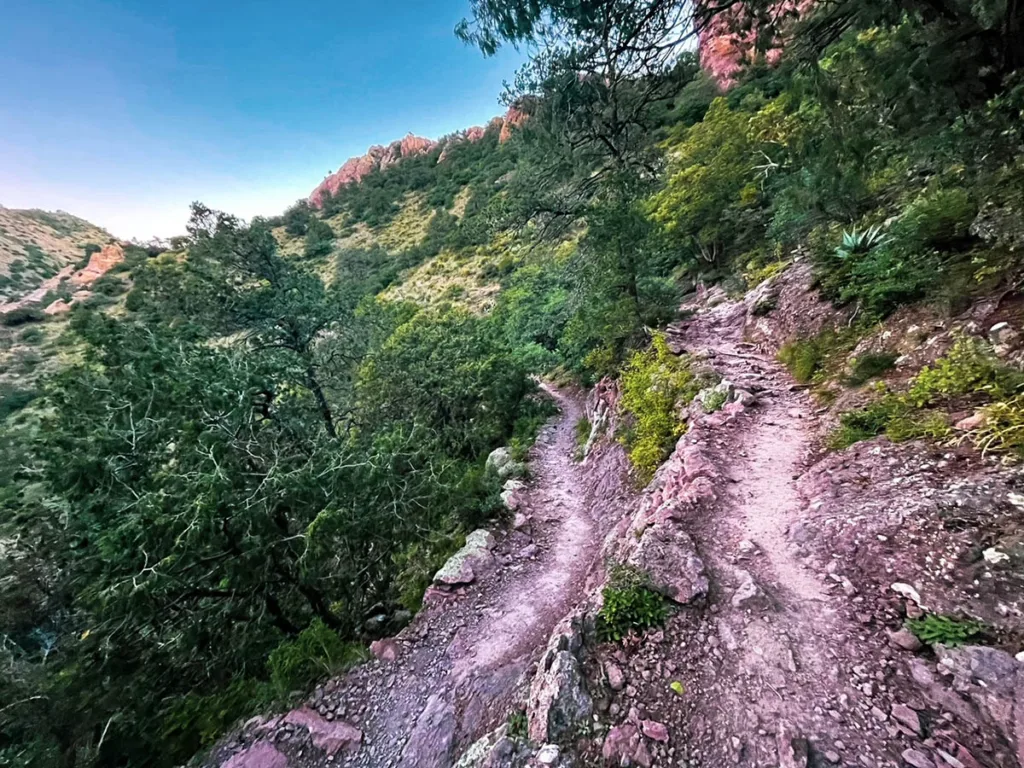
A little over a mile into the trail you’ll hit a series of switchbacks. These switchbacks will take you up the side of the mountain here. Although, they are not steep or otherwise difficult switchbacks. They actually are quite long ones that wind it’s way up the hill. For most people they won’t have too much trouble with these.
About a mile after the start of the switchbacks, the trail will straighten out some. You’ll be back on a rocky, brushy area with a few small turns until you reach the first part of the summit.

From here the ground is rocky from being on the summit of the hill here. You’ll think you may be at the end of the trail, however there is still a bit more to go. If you look ahead, you’ll see a ridge that makes an arc. Follow the ridge until the end and you’ll come to another rocky area. Be careful if the wind is high here! It did feel at times that I could be blown away.

This is where the summit and end of the hike is. From here you’ll have a few spots where you can sit and relax. It also affords some great views of the area. We highly recommend coming for sunrise or sunset if you can, as the light is better then.

It’s also a good spot to have a coat or windbreaker. We found it to be incredibly windy at the top. You’ll enjoy it better if you are not freezing cold. We took the opportunity for snacks and photos. From here, whenever you are ready, return to the trailhead along the same trail you ascended. If you leave early like we did you may not see another person until you are on your way down!
Tips & FAQs
- Bring a headlamp. The best light and time is either early or late to see the sunrise or sunset. The trail is very dark at night, so bring a lamp.
- Bring a windbreaker or jacket even if it’s during the warmer seasons. Near the top we experienced some high winds and colder weather. You’ll want something with you to enjoy the summit.
- Wear good footwear. Closer to the summit the peak is pretty rocky and you’ll need to traverse to a second peak area as well. You don’t need boots but you’ll want some sturdy footwear.
- Bring water, sunscreen, etc. Be prepared. The sun can be hot and you should always make sure to have enough water. Water is not available on the trail.
- Arrive early to the trailhead. Unsurprisingly the trail is very popular and sadly the parking area is very small. Finding a spot can be tough and during peak times you may have to park far away. Plus hiking mid-day is far less pleasant anyway.
Other Posts You May Like
- TEXAS: Guide to the Santa Elena Canyon Trail
- TEXAS: Best Things to Do in Guadalupe Mountains National Park
- TEXAS: Best Things to Do in El Paso Texas
- NEW MEXICO: Best Things to Do in Las Cruces
- NEW MEXICO: Best Things to Do in Santa Fe
Leave a Reply